


Viridien has announced a new regional multi-client data initiative for the offshore basins of India, designed to deliver enhanced, data-driven exploration capabilities to industry operators…
Published
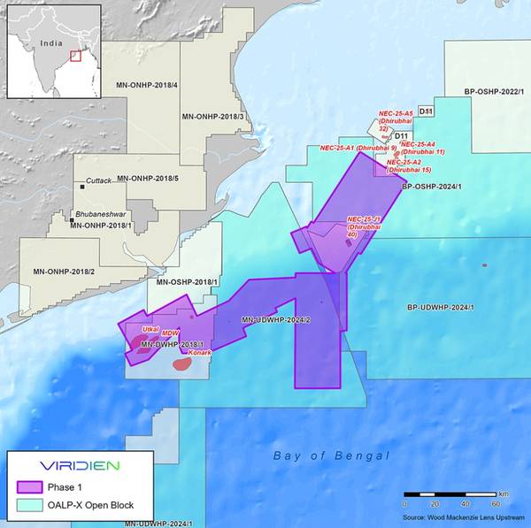
Viridien has announced a new regional multi-client data initiative for the offshore basins of India, designed to deliver enhanced, data-driven exploration capabilities to industry operators.
The initiative will start with Phase 1 Mahanadi Basin reimaging and merging of approximately 9000 sq km of 3D seismic data over the offshore East Coast Mahanadi Basin.
Fast-track results will be ready by June 2026, with final data available by the end of 2026.
The aim of the Phase 1 Mahanadi Basin reimaging project is to provide higher-quality imaging over proven petroleum system areas, as well as deeper water areas where exploration of new thermogenic plays has been challenging due to low-quality imaging of legacy data.
Viridien will apply the latest imaging technologies, such as time-lag full-waveform inversion (TLFWI) and least-squares PSDM (LSQPDSM), to address these challenges and produce seamless, high-quality merged 3D datasets.
“The innovative imaging technology and regional expertise provided by Viridien, combined with phased project
Content Original Link:
" target="_blank">


